Introduction
Spatial analytics has emerged as a cornerstone of modern governance, enabling governments and planning authorities to make informed decisions based on location intelligence and geospatial insights. In 2026, the integration of spatial data analysis into public-sector planning processes has become essential for addressing urban challenges, optimizing resource allocation, and ensuring equitable service delivery. By leveraging GIS analytics and advanced spatial techniques, government agencies can transform complex geographic information into strategic action plans that drive sustainable development and improve citizen welfare.
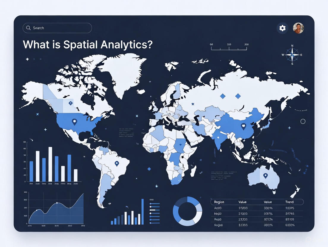
What is Spatial Analytics?
Spatial analytics refers to the systematic examination and interpretation of location-based data to uncover patterns, relationships, and trends that inform decision-making processes. This analytical approach combines geographic information systems, mapping technologies, and statistical methods to answer critical questions about where events occur, why they happen in specific locations, and how spatial factors influence outcomes.
At its core, spatial analytics involves the collection and integration of diverse spatial datasets including satellite imagery, demographic information, infrastructure networks, land-use classifications, and environmental variables. These datasets are processed using specialized GIS software and analytical algorithms to generate insights that would remain hidden in traditional non-spatial analysis. The output transforms raw geographic data into visual maps, statistical reports, and predictive models that support evidence-based planning and policy formulation.
Key Applications of Spatial Analytics
Government agencies and planning authorities deploy spatial analytics across multiple domains to enhance governance effectiveness and service delivery:
Urban and regional planning: Spatial analytics supports comprehensive master plan preparation by analyzing existing land-use patterns, identifying growth corridors, assessing infrastructure adequacy, and modeling future development scenarios. Planning departments utilize geospatial analysis to evaluate site suitability for residential, commercial, and industrial zones while ensuring compliance with environmental regulations and sustainability objectives.
Infrastructure and transport planning: Transportation authorities employ location intelligence to optimize road network layouts, select metro corridor alignments, plan bus route networks, and identify areas requiring traffic management interventions. Spatial data analysis helps minimize construction costs, reduce environmental impacts, and maximize connectivity benefits for urban populations.
Land-use and spatial change analysis: Multi-temporal satellite imagery analysis enables government agencies to monitor urbanization trends, quantify agricultural land conversion, detect unauthorized constructions, and assess forest cover changes. These insights support regulatory enforcement, conservation planning, and policy adjustments to manage urban sprawl effectively.
Environmental monitoring: Environmental agencies leverage spatial analytics for watershed management, air quality assessment, flood risk mapping, and biodiversity conservation. Geospatial analysis identifies pollution hotspots, models climate change impacts, and prioritizes areas for ecological restoration and protection measures.
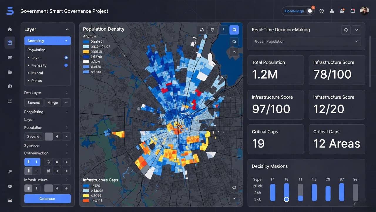
Smart city governance: Smart City Special Purpose Vehicles integrate real-time spatial data from IoT sensors, citizen service platforms, and monitoring systems into command center dashboards. This enables city administrators to track service delivery performance spatially, identify infrastructure gaps, coordinate emergency responses, and optimize municipal resource deployment across wards and zones.
Role of Spatial Analytics in Decision Making
Spatial analytics strengthens organizational decision-making by providing location-based evidence that reduces uncertainty and supports rational policy choices. Government planners utilize spatial decision-making frameworks to evaluate multiple alternatives, assess trade-offs between competing objectives, and select options that maximize public welfare within budgetary and regulatory constraints.
Evidence-based decisions: By grounding policy choices in empirical spatial data rather than intuition or anecdotal observations, spatial analytics ensures that government decisions withstand technical scrutiny and public accountability expectations. Spatial evidence demonstrates due diligence in project selection and resource allocation processes.
Risk identification and mitigation: Geospatial analysis reveals spatial vulnerabilities related to natural hazards, infrastructure failures, and environmental degradation. This enables proactive risk mitigation through targeted investments in disaster preparedness, infrastructure upgrades, and land-use controls in high-risk zones.
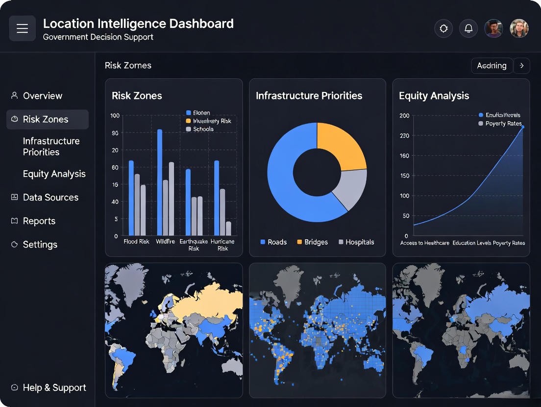
Resource optimization: Multi-criteria spatial evaluation frameworks incorporate distance factors, demographic characteristics, service coverage gaps, and equity considerations to prioritize infrastructure projects and allocate budgets across competing needs. This ensures efficient utilization of limited public resources.
Location-based policy formulation: Spatial analytics informs zoning regulations, development incentives, service delivery standards, and targeted intervention programs by quantifying spatial disparities and identifying underserved areas requiring focused government attention.
Decision Support Systems and Spatial Decision Support
Decision Support Systems (DSS) provide structured computational frameworks that combine databases, analytical models, and user interfaces to facilitate organizational decision processes. Spatial Decision Support Systems (SDSS) extend these capabilities by integrating geospatial data, location intelligence, and spatial analysis algorithms to address decisions with explicit geographic dimensions. Government implementations include Smart City command centers that provide real-time situational awareness, infrastructure planning tools that evaluate corridor alternatives, and disaster management platforms that coordinate emergency response operations across jurisdictions.
Spatial Analytics for Government and Smart Cities
Government procurement of spatial analytics services through competitive tenders and Requests for Proposals emphasizes technical competence, methodological soundness, and demonstrated experience with similar public-sector projects. Technical evaluation committees assess proposals based on the depth of geospatial analysis expertise, quality of proposed methodologies, and alignment with government GIS standards and planning guidelines.
Planning Authorities: State Town and Country Planning Departments, Development Authorities, and Regional Planning Boards procure spatial analytics services for master plan preparation, regional development studies, and land-use policy formulation requiring comprehensive territorial analysis and scenario modeling capabilities.
Smart City SPVs: Special Purpose Vehicles implementing Smart Cities Mission require spatial analytics for Area-Based Development planning, Pan-City Solutions design, command and control center implementation, and spatial performance monitoring aligned with evaluation frameworks specified in Smart City proposals.
Line Departments: Sector-specific agencies including Public Works Departments, Water Supply Boards, Transport Corporations, and Electricity Distribution Companies engage spatial analytics providers for infrastructure network planning, asset management system development, and service coverage optimization that demand location intelligence integration and GIS-based decision support.
DS Technoverse delivers government-grade spatial analytics solutions that align with procurement specifications, regulatory standards, and institutional decision-making contexts. Our services support planning authorities, Smart City SPVs, and line departments in achieving evidence-based governance objectives through rigorous geospatial analysis and location intelligence capabilities. Visit https://dstechnoverse.com/ to explore our spatial analytics portfolio and government client success stories.
Conclusion
Spatial analytics has evolved from a technical specialty to a strategic necessity for effective governance in 2026. By transforming location-based data into actionable intelligence, spatial analytics enables government agencies to plan smarter infrastructure, allocate resources equitably, manage risks proactively, and deliver services efficiently. The integration of geospatial analysis with Decision Support Systems empowers planners and policymakers to make evidence-based choices that advance sustainable development objectives and improve quality of life for citizens.
As urbanization accelerates and governance challenges grow more complex, spatial analytics will continue to play an increasingly vital role in smart city implementations, regional planning initiatives, and infrastructure modernization programs across India. Government agencies that invest in spatial analytics capabilities position themselves to achieve superior planning outcomes, transparent decision processes, and measurable development impacts that benefit communities and strengthen public trust in governance institutions.