
The way organizations understand and use location-based information has transformed dramatically over the past few years. In 2026, GIS Analytics has become essential infrastructure for governments, enterprises, and planning agencies worldwide. What was once a specialized mapping tool has evolved into a comprehensive decision-support system that combines spatial data with real-time intelligence, predictive modeling, and business analytics. Organizations that leverage geospatial analysis today gain measurable advantages in planning accuracy, risk management, and resource allocation.
GIS Analytics refers to the systematic examination of geographic and spatial data to uncover patterns, relationships, and insights that support better decision-making. Unlike basic mapping that simply shows where things are located, spatial analytics goes deeper by answering questions about why locations matter, how different factors interact across space, and what outcomes we can expect from spatial patterns.
This analytical approach combines location data with demographic information, environmental conditions, infrastructure networks, and business metrics. The result is actionable intelligence that helps organizations understand complex situations, identify opportunities, and anticipate challenges before they become problems.
The capabilities available through geospatial analysis have expanded significantly. Real-time data integration now allows analysts to monitor changing conditions as they happen, whether tracking traffic patterns, environmental conditions, or infrastructure performance. This immediacy transforms how organizations respond to emerging situations.
Predictive analysis has become standard practice in location intelligence. By examining historical spatial patterns alongside current data, organizations can forecast future scenarios with increasing accuracy. Urban planners model growth patterns, infrastructure managers predict maintenance needs, and environmental agencies anticipate ecological changes.
Data-driven planning has replaced guesswork in many sectors. The combination of comprehensive spatial datasets, advanced analytical methods, and visualization tools means decisions are grounded in evidence rather than assumptions. This shift has improved outcomes across government services, commercial operations, and development projects.
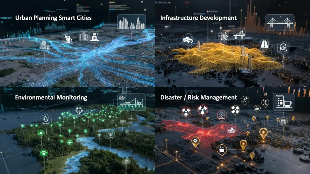
Organizations across sectors rely on geospatial analysis for critical operations:
The value of spatial analytics extends beyond technical capabilities to tangible organizational benefits. Policy decisions backed by geospatial analysis carry greater credibility and produce better outcomes because they account for real-world spatial relationships and constraints.
Cost optimization follows naturally when organizations understand geographic factors affecting their operations. Whether reducing transportation expenses, improving service coverage, or avoiding unsuitable development sites, location intelligence identifies savings that spreadsheets alone cannot reveal.
Risk identification becomes more comprehensive with geospatial analysis. Organizations can visualize exposure to natural hazards, infrastructure vulnerabilities, demographic shifts, or competitive pressures. This spatial perspective on risk enables proactive rather than reactive management.
Improved transparency and planning accuracy strengthen stakeholder confidence. When decisions are supported by clear spatial evidence and visualizations, everyone can understand the rationale. This openness builds trust and facilitates collaboration among diverse stakeholders.
DStechnoverse provides professional GIS Analytics services designed for the real-world challenges facing government agencies, infrastructure firms, and enterprises in 2026. Our approach combines technical expertise with practical understanding of how organizations make decisions.
Our expert-led analytical approach ensures that spatial data analysis directly addresses your specific questions and objectives. We don’t simply generate maps—we deliver insights that guide action. Our team brings experience across urban planning, infrastructure development, environmental assessment, and business intelligence.
We work with accurate spatial datasets from authoritative sources, enhanced with your organization’s operational data. This combination produces reliable analysis that stakeholders can trust. Our spatial data analysis and visualization services transform complex geographic information into clear, understandable formats.
Custom analytics for different sectors recognize that government planning agencies, engineering firms, environmental consultants, and commercial enterprises each face distinct challenges. DStechnoverse tailors our geospatial analysis methods to your industry requirements and decision-making processes.
Our infrastructure and urban planning analytics support development projects from initial feasibility through implementation monitoring. We provide environmental and risk assessment services that identify concerns early and support compliance requirements. Our decision-support systems using geospatial data integrate with your existing workflows, delivering scalable and compliant solutions that grow with your needs.
What is GIS Analytics used for in 2026?
GIS Analytics is used for data-driven decision-making across government, infrastructure, environmental management, and business operations. It helps organizations understand spatial patterns, predict future scenarios, optimize resource allocation, and identify risks by analyzing location-based information alongside operational data.
How does GIS Analytics support urban planning?
Spatial analytics supports urban planning by analyzing land use patterns, modeling growth scenarios, optimizing transportation networks, and evaluating infrastructure capacity. Planners use geospatial analysis to make evidence-based decisions about zoning, development priorities, and service delivery that account for real-world geographic constraints.
Is GIS Analytics useful for infrastructure projects?
Absolutely. Infrastructure projects rely on geospatial analysis for site selection, route optimization, environmental impact assessment, and construction monitoring. Location intelligence helps identify suitable locations, avoid conflicts with existing infrastructure, understand terrain challenges, and track project progress spatially.
Why should organizations invest in GIS Analytics?
Organizations invest in location intelligence because it improves decision quality, reduces costs, identifies risks early, and provides competitive advantages. Geospatial analysis reveals insights that traditional data analysis misses by incorporating the geographic dimensions of business operations and planning challenges.
What makes professional GIS Analytics services valuable?
Professional services bring specialized expertise in spatial data management, analytical methods, and industry applications that most organizations don’t maintain in-house. Expert providers deliver accurate, reliable analysis faster and ensure results meet quality standards and compliance requirements.